The launching of satellites into Earth orbit has grown enormously in recent years. Thanks to them, we can know what the weather will be like in the coming days, we have access to the Internet in remote places, it is possible to monitor global pollution and much more. Now, Google plans to invest in the launch of satellite constellations to detect forest fires.
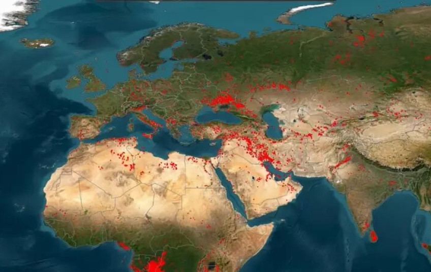
Google isn't doing anything new. Satellites have long been used to monitor fires on Earth. However, there hasn't been a satellite group that has focused solely on that. The non-profit organization Earth Fire Alliance (EFA) wants to change that, and it will do so with the FireSat constellation.
For the development of satellites and their launches, the EFA needs money and Google is willing to help. On Monday, it announced a new investment of 13 million dollars in the FireSat constellation and, previously, it has already contributed with the creation of customized infrared sensors for the FireSat satellites.
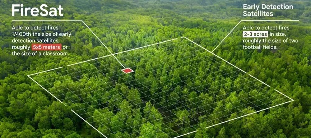
With the new financial backing from the technology company, the EFA could deploy more than 50 small satellites into low Earth orbit. These would be used to locate forest fires the size of a small room, which are usually difficult to detect.
Often, when a forest fire is detected, it is already too late. It is then more difficult to put an end to it. According to a mid-August report by the Ministry of Ecological Transition, 3,966 fires have occurred in Spain alone, affecting more than 34,000 hectares of forests, scrubland and pastures in 2024. With the use of satellites for early detection, these numbers could be reduced and that is the goal of the EFA and the philanthropic part of Google.
When will the FireSat constellation be launched?
According to the EFA, Google's funding commitment is key to the launch of the first FireSat Pathfinder satellite next year. This spacecraft will be a test, but the first batch of satellites forming an operational constellation is not expected to arrive until 2026. The dates are indicative and, at the moment, neither the month nor the day on which these satellites will be deployed is known.
Although there is still a long way to go before the money Google has put into the project will be reflected, Earth Fire Alliance explains that the investment is “a significant milestone and a step towards transforming the way we interact with fire.” With global warming, we have witnessed how fires are becoming more intense and spreading faster. Thanks to space technology, the EFA hopes to improve the management of these catastrophes and eradicate them in time to avoid greater evils.
What will FireSat satellites be like?
Neither the EFA nor Google will be responsible for manufacturing the satellites that will detect forest fires. This task will be carried out by Muon Space, a start-up based in California (USA). According to the press release, its team will manufacture microsatellites with multispectral infrared instruments in six bands. Each band will be able to observe swaths of the Earth approximately 1,500 kilometers wide. The technology with which they will be equipped will allow the satellites to locate hot spots that could be fires.
The big difference with FireSats compared to other satellites currently used to detect fires is their high sensitivity. Muon Space is developing them to be able to detect fires up to 5 x 5 meters in size. To achieve this capability, they will use Google's artificial intelligence, which will be used to evaluate factors such as local weather or nearby infrastructure. In this way, FireSats will be able to detect when there is a fire and when there is not.

Once satellites identify a wildfire, information about its location and size must be quickly disseminated to emergency services. The time it takes will be crucial to extinguish the fire before it spreads, so this will also be something Muon Space will have to take into account. With the first three satellites it launches, the company expects to observe every point on Earth at least twice a day. But with more than 50 FireSatls, review times could be as short as every 20 minutes (or 9 minutes in the most fire-prone areas).


